Wednesday, November 6, 2013

Monches Segment

2 Weekends. 2 Hikes. 2 Blog Posts. After over a year of radio silence around here it can only be a good thing.  I supposed that the sensible thing to do would have been to hike the second half of the Lapham Peak Segment, but we were both looking for a change of scenery, so we grabbed our trusty Ice Age Trail Companion guide and decided on the Monches Segment - the northernmost stretch of the trail in Waukesha County.

This 3.1 mile long segment mostly parallels the Oconomowoc River as it winds its way through a mature maple forest, over babbling brooks, and through a small stretch of prairie.  When we arrived at the trailhead,  we joked that it was the most "ghetto-tastic" trailhead we'd seen so far - made somewhat ironic considering that the average home price in that area is somewhere around $500,000!


A few steps into the woods and all thoughts of graffiti were quickly forgotten as we came to the first bridge, and a lovely brook.


Soon we crossed onto private land with great views of the river.

Soon enough we were back on public land and another winding boardwalk was waiting to carry us over the river - and past the dog who surprised his owners by diving off the side and going for an impromptu swim!


We meandered through a short prairie section before rejoining the maple forest in all its fall glory.


There were a few gentle hills in the woods, but nothing too intense. In fact, if you're looking for a short, easy hike; this segment is perfect. The only really noticeable hill came as we reached the end and hiked down the remnants of another glacial river - and to the border of the next county (Washington).  Unfortunately, the impending hunting season will likely prevent us from exploring this part of the trail until next spring. (*cue pouting*)

After that, there was nothing to do but turnaround and retrace our steps - and enjoy all the beautiful sights again. 


Miles Hiked: 3.10
Total Miles Completed: 9.70

Sunday, November 3, 2013

Lapham Peak Segment (Part 1)

So...I guess it's been a while since we did any hiking on the Ice Age Trail.  This little endeavor sort of fell by the wayside as these sorts of endeavors often do.  It took a random hike one Sunday afternoon on the Moraine Ridge Trail at the Lapham Peak Unit of the Kettle Moraine Forest, where the yellow-blazed trail of the Ice Age makes several crossings, to remind us of our desire to section hike the entire Ice Age Trail. 

The Lapham Peak Segment is a 7.8 mile long, hilly section of the The Trail that winds through woods, prairies, and meadows that were once part of a glacial spillway (river).  In an effort not to have to take two vehicles in order to park at one end of the segment and drive to the other end, we've decided to split the Lapham Peak Segment into two hikes. The first of these hikes occurred last Sunday.


We started from the Evergreen Grove parking area at Lapham Peak and followed the blue blazed connector trail until it met up with the yellow blazes and we were off for a quad-burning first mile almost straight uphill!
 The burning was worth it when we spotted a hawk coming in for a landing in a nearby tree.


We passed by the highest point in Waukesha County (1,223 ft above sea level) which is crowned with a 45 foot observation tower that provides 360 degree views of the surrounding area on clear days.
We proceeded down the dozens of shallow stairs and continued along the rocky, narrow path to where it intersected the Moraine Ridge and Kettle View trails and continued South. The terrain was mostly rolling hills, punctuated by the usual rocks and roots - and we encountered only a handful of other hikers; especially after we walked beyond the Lapham Peak Unit boundaries.


 Eventually, after one busy road-crossing, we popped out at (what we thought was) the Southern terminus of the Lapham Peak Segment.  It turns out we need to go back and walk a little section that coincides with the Glacial Drumlin trail to truly hit the end - although to be fair, you'd think it was done when we saw the sign on the other end!
After a brief stop by a creek for a snack, we turned around and headed back the way we came.  The way back was equally pleasant, with the exception of having to climb up all those stairs to the tower!
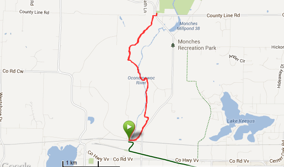


Miles Hiked : 3.50
Total Miles Completed: 6.60

Monday, April 30, 2012

Stoney Ridge Segment

The Stoney Ridge segment is located in Southern Wisconsin and marks the beginning of the Waukesha County portion of the Ice Age Trail. It also marks the beginning of our attempt to 'Follow The Yellow Blaze Trail' in its entirety.  We do have a plan to post more information about the Ice Age Trail, but the siren song of the trail was too strong so we started the trek; there is always time to add the details later.

After fueling up on coffee and carbs (in donut form) we arrived at the trailhead.


No matter how many times we asked, the friendly Wooly Mammoth refused to take our picture by the sign... so this is the best we could do.


The trail began by winding through a section of dry prairie that was anything but dry due to the recent rains.  In fact, it was quite muddy! Eventually the gentle, rolling hills of the prairie gave way to hardwood forests, pine plantations, and a few steep uphills and descents.   The "nature" portion of the hike was fairly uneventful.   We spotted a hawk soaring above, a few rouge chipmunks skittering in the brush and a couple of hounds taking their humans for a walk.  The rest of the story is probably best told through pictures.  Enjoy!

The Ice Age Trail is conveniently marked with Yellow Blazes to guide the hiker across the state.

Prairie (which was NOT dry)


Bridge over muddy waters

Field and Stream

Hardwood forest marks the end of the prairie

Pine Plantation


Can you guess what the Wisconsin state flower is?

Eastern Tent Caterpillar Nest


Stoney Ridge Segment According to Garmin

Total Miles In Waukesha County Segment: 40 miles
Total Miles Completed: 3.1 miles

Until next time...follow the yellow blaze trail!